
The National Weather Service has updated its snowfall prediction for the storm that will arrive in the area Saturday morning.
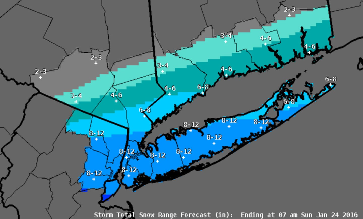
The main change affected the Hudson Valley is an increase in the snowfall projection for much of Westchester and Rockland to between 4 and 8 inches, except for the northern-most parts of both counties. Southern-most Westchester could see between 8 and 12 inches of accumulation.
A Winter Storm Watch is in effect from 6 a.m. Saturday until 1 p.m. Sunday for Westchester, Putnam and Rockland counties. A Winter Storm Warning is in effect for that same period in Southern Westchester, where coastal flooding at high tides expected. There is no watch or warning in effect for Dutchess.
Strong gusty of between 50 and 60 miles per hour are expected along coastal areas with power outages possible.
Forecasters are predicting lesser amounts of snow for those in the northern parts of the Lower Hudson Valley. In fact, Dutchess could see little accumulation while sections of Putnam County and Northern Westchester could see between 3-6 inches of snow.
According to the weather service, snow totals will increase for those in the south. Rockland County could see between 4-6 inches of snow while southern sections of Westchester, parts of New Jersey, New York City and Long Island could see between 6-8 inches.
According to the weather service, where and how the storm tracks will ultimately affect localized snow totals.
If the storm tracks closer to the coast, for example, totals for those in New York City and points north and west would increase while much of Long Island would see mostly sleet and rain.
If the storm tracks further south or offshore, the Lower Hudson Valley could largely be spared of significant snowfall all together, according to the weather service.
Forecasters also noted that the speed of the storm will impact the storm's severity; a faster track is likely to produce less snow while a slower track will pad snow totals. According to the weather service, there is some potential for parts of the region to see 12 inches or more.
Friday should be the calm before the storm as clouds build with high temperatures in the lower 30s.
Check back to Daily Voice for updates.
Click here to follow Daily Voice Mamaroneck and receive free news updates.